
Municipal Community of Vathy, Samos
🏘️ Municipal Community of Vathy, Samos – Historic Ano Vathy and the Surrounding Settlements
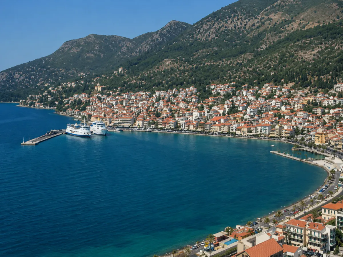
The Municipal Community of Vathy is located in northeastern Samos and extends around the historic settlement of Vathy, the hillsides above the bay of the same name and a broad area of smaller settlements, agricultural zones, monasteries and coastal locations.
The central settlement of the community is Vathy, also known as Ano Vathy or Old Vathy. It is built amphitheatrically above the town of Samos, with which it has almost merged through continuous urban development, while retaining its own historical, residential and administrative identity.
The community includes a total of nineteen officially registered settlements. From the densely built historic neighbourhoods of Vathy to the Vlamari valley, the monasteries of Agia Zoni and Zoodochos Pigi, the cultivated countryside and the coast of Kedron, it presents one of the most varied geographical landscapes of eastern Samos.
📍 Location and geographical character
The Municipal Community of Vathy occupies part of northeastern Samos, around the inner Bay of Vathy and the hills rising to its east, south and west.
The central settlement is built at an average elevation of approximately 50 metres, on the slopes of the Koutsomylos and Varela hills. The densely developed residential zone follows the natural gradients of the terrain and descends gradually towards the town of Samos and the innermost part of the bay.
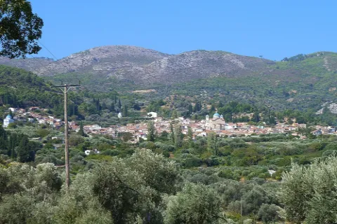
The territory of the community includes hilly areas, small valleys, olive groves, cultivated land, forested zones and coastal locations. Towards the east, the landscape becomes more mountainous and offers views towards the Mykale Strait and the coast of Asia Minor.
🏛️ Administrative identity of the community
The Municipal Community of Vathy belongs to:
✅ The Municipal Unit of Vathy
✅ The Municipality of Eastern Samos
✅ The Regional Unit of Samos
✅ The North Aegean Region
The community was officially established on 21 September 1918, with the settlement of Vathy as its administrative centre. During the following decades, the smaller settlements that form its present administrative composition were gradually annexed or officially recognised.
Following the administrative reform of 1997, it became part of the former Municipality of Vathy, in 2010 of the unified Municipality of Samos and, since 2019, it has formed part of the Municipality of Eastern Samos.
🗺️ The settlements of the Municipal Community of Vathy
The Municipal Community of Vathy includes nineteen officially registered settlements:
✅ Agia Zoni
✅ Agia Markella
✅ Agia Triada
✅ Ai Thanasis
✅ Vathy
✅ Varela
✅ Drosia
✅ Zervou
✅ Zoodochos Pigi
✅ Kamara
✅ Kedron
✅ Koumarionas
✅ Mesokampos
✅ Moraitochori
✅ Nikola
✅ Panaitsa
✅ Platanos
✅ Tourkomylonas
✅ Floka
Some of these are small residential centres close to Vathy, while others are located within agricultural, coastal or monastic areas of the community.
👥 Population and residential distribution
According to the 2021 Population Census, the Municipal Community of Vathy has 3,767 permanent residents. In the 2011 Census, 3,026 residents were recorded.
The largest residential centre is Vathy, while a significant part of the population lives in the surrounding areas that have developed along the main roads and on the outskirts of the wider urban area.
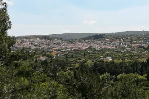
The smaller settlements retain a more scattered layout and a stronger agricultural character, with houses, small cultivated plots, olive groves and areas of natural vegetation.
📜 The establishment and historical development of Vathy
Vathy is one of the oldest settlements established after the repopulation of Samos during the 16th century.
The first organised neighbourhood was formed around the middle of the 16th century by inhabitants who came from Chios or by families of Samians who had taken refuge there during the period when the island was largely abandoned. This neighbourhood became known as Chiotika.
During the 18th century, families from the Peloponnese settled in the area, particularly after the political and military changes that followed 1718. These residents established Moraitochori, which retained its own spatial and residential identity.
The first neighbourhoods developed in locations that were not easily visible from the sea, providing greater protection against pirate raids. Over time, the settlement expanded across the hillsides and acquired its present amphitheatrical form.
📝 The name Vathy
The name “Vathy” is associated with the settlement’s position at the deepest inner part of the large natural bay.
The historic settlement is also known as Ano Vathy or Old Vathy. These names were used to distinguish it from the coastal settlement that developed further downhill and was known as Gialos, Kato Vathy or Limen Vatheos.
The coastal settlement developed into the present-day town of Samos, while historic Vathy remained organised across the hillsides above the harbour.
🏙️ The connection with the town of Samos
Vathy and the town of Samos now form an almost continuous urban area, as newer neighbourhoods and roads have reduced the open spaces that once separated them.
The town of Samos is a different officially recognised settlement and belongs to the Municipal Community of Samioi. It contains the administrative seat of the Municipality of Eastern Samos, the main harbour, the hospital, most public services, museums and the largest concentration of commercial activity.
Vathy retains a more traditional character, with dense residential development, steep alleys, historic churches and neighbourhoods that follow the slopes of the surrounding hills.
🏘️ The form and architecture of Vathy
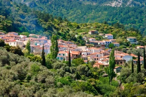
Vathy is built amphitheatrically across steeply sloping terrain. The arrangement of the houses follows the natural relief, creating a dense network of narrow streets, stairways, stone-paved passages and small neighbourhoods.
The older residential centre includes:
✅ Two-storey houses with tiled roofs
✅ Stone-built ground floors and rendered façades
✅ Wooden window frames and small balconies
✅ External staircases
✅ Courtyards with flowers and vines
✅ Narrow passages without vehicle access
✅ Locations with panoramic views over the bay
Traditional architecture coexists with more recent buildings, without completely losing the appearance of an old Samian village.
🏡 Chiotika and Moraitochori
Chiotika is one of the oldest parts of Vathy and is connected with the first residents who arrived in the area following the repopulation of Samos.
Moraitochori was established by families originating from different regions of the Peloponnese. Its name comes from Morea, the historical name widely used for the Peloponnese.
The two historic neighbourhoods initially developed in protected locations behind the hills. Chiotika gradually expanded towards the present centre of Vathy, while Moraitochori retained a more distinct residential form.
⛪ Churches and religious tradition
Religious architecture is a fundamental element of the historic character of Vathy.
The three principal parish churches are:
✅ Presentation of the Virgin Mary: A church associated with the historical development of the old neighbourhoods
✅ Dormition of the Virgin Mary: A three-aisled domed basilica constructed in 1802
✅ Transfiguration of the Saviour: A church constructed in 1834
The area also contains smaller churches, chapels and older religious locations associated with the different neighbourhoods and the families of the first settlers.
⛪ The post-Byzantine Church of Ai-Giannakis
Ai-Giannakis is one of the most important post-Byzantine monuments of Samos.
It is a twin church consisting of two parallel and almost identical aisles. One is dedicated to Saint John the Baptist and the other to Saint Nicholas.
The church is distinguished by its four domes, central bell tower, symmetrical design, decorative glazed plates on the exterior walls and old religious paintings preserved inside.
Its architectural form and painted decoration are connected with the post-Byzantine art of the 18th and 19th centuries. Following the completion of restoration work, the church reopened to visitors in 2026.
🏫 The Urban School of Vathy
The Urban School of Vathy is a characteristic example of the educational and architectural development of the settlement during the early 20th century.
The neoclassical building was constructed in 1901 and is associated with a period when organised education and community institutions were particularly important to Samian society.
Its form, symmetrical façades and historical use make it one of the most characteristic public buildings of Old Vathy.
⛪ Agia Zoni Monastery
The Holy Monastery of Agia Zoni is located in the green Vlamari valley, within the administrative boundaries of the community.
It was founded in 1695 by the hieromonk Meletios with the assistance of local residents and was recognised as a stavropegic monastery.
Its main church has the form of a single-aisled vaulted basilica with a dome. A small marble bell tower constructed in 1751 stands on its exterior.
The monastery is surrounded by olive groves, cultivated land and dense vegetation, creating a peaceful religious and natural destination.
⛪ Zoodochos Pigi Monastery
The Holy Monastery of Zoodochos Pigi, also known as Ailiotissa, is located in the easternmost part of Samos, on Mount Rambaidoni and close to Cape Prasso.
It was founded in 1756 by the hieromonk Dorotheos on the site of an older chapel. The monastic complex follows a quadrilateral plan, with two-storey wings surrounding the main church.
The position of the monastery offers extensive views over the Mykale Strait, the eastern coast of Samos and Asia Minor.
Access is provided by a paved mountain road passing through pine forest and areas of low Mediterranean vegetation.
🌿 Natural environment and agricultural landscape
Outside the densely developed centre of Vathy, the community retains extensive zones with an agricultural and natural character.
The landscape includes:
✅ Olive groves
✅ Small vineyards
✅ Fruit trees
✅ Vegetable gardens
✅ Pine forests
✅ Cypress trees
✅ Mediterranean shrubs
✅ Streams and small valleys
Vlamari is one of the most characteristic fertile areas, with olive groves, cultivated land and small residential centres.
In the past, local production included wine, olives, raisins, almonds, citrus fruits, figs, silk and tobacco. Today, olive cultivation, small family farms and local product manufacturing remain visible elements of the countryside.
🌊 Kedron and the coastal zone
Kedron is the main coastal settlement of the Municipal Community of Vathy and is located on the northern coast, west of the bay.
The area combines low-density development, holiday homes, accommodation facilities, olive groves and direct access to the sea.
Kedron Beach is mainly pebbled, with clear water and an open horizon towards the northern Aegean Sea. Because of its northern orientation, it may be affected by the meltemi wind and experience waves.
The coastal zone offers a different experience from the densely developed Ano Vathy and allows visitors to combine exploration of the community with swimming and coastal accommodation.
🏘️ The smaller settlements and neighbourhoods
The smaller settlements of the community have different forms and functions.
Kamara, Varela, Drosia, Floka, Koumarionas and Moraitochori are located close to the principal urban area and are functionally connected with Vathy and the town of Samos.
Agia Zoni, Zervou, Zoodochos Pigi, Agia Triada, Agia Markella and Ai Thanasis retain a stronger agricultural or religious character.
Mesokampos, Nikola, Panaitsa, Platanos and Tourkomylonas consist of scattered houses, agricultural land and small local roads.
The different character of these settlements creates a community that combines urban outskirts, old neighbourhoods, agricultural countryside, coastal areas and mountainous religious monuments.
🛍️ Daily life and services
The central settlement of Vathy has small shops, traditional cafés, dining establishments and educational and social facilities.
Because of its immediate proximity to the town of Samos, residents have easy access to:
✅ Samos General Hospital
✅ Public and municipal services
✅ Banks and commercial shops
✅ The harbour of Samos
✅ Schools and educational institutions
✅ Museums and cultural venues
✅ A wider range of accommodation and dining options
Parking is limited in the narrow streets of Old Vathy. Exploring is easier on foot after leaving the car in an open area near one of the main roads.
🥾 Walks and exploration routes
The community offers different routes for walking, historical exploration and contact with nature:
✅ Exploring the alleys of Ano Vathy
✅ A route through the Chiotika and Moraitochori neighbourhoods
✅ A walk towards Ai-Giannakis and the historic churches
✅ A route from Vathy towards the Vlamari valley
✅ A visit to Agia Zoni Monastery
✅ A mountain route towards Zoodochos Pigi Monastery
✅ Exploring the olive groves and smaller agricultural settlements
✅ Descending towards Kedron and the northern coast
The old alleys have steep gradients, steps and uneven sections. Comfortable shoes, drinking water and sun protection are required for longer walks.
🌿 What to see
During your exploration of the Municipal Community of Vathy, look for:
✅ Historic Ano Vathy
✅ The narrow uphill alleys
✅ The houses with tiled roofs and traditional courtyards
✅ The old neighbourhoods of Chiotika and Moraitochori
✅ The panoramic view over the Bay of Vathy
✅ The post-Byzantine Church of Ai-Giannakis
✅ The Church of the Dormition of the Virgin Mary
✅ The Church of the Presentation of the Virgin Mary
✅ The Church of the Transfiguration of the Saviour
✅ The Urban School of Vathy building
✅ Agia Zoni Monastery in Vlamari
✅ Zoodochos Pigi Monastery
✅ The olive groves and agricultural landscape
✅ The coastal settlement of Kedron
✅ The viewpoints towards Asia Minor
🚗 Suggested routes
The large geographical extent of the community allows different combinations:
✅ Ano Vathy – Chiotika – Moraitochori: A historical route through the oldest neighbourhoods.
✅ Ano Vathy – Ai-Giannakis – Urban School: A route focusing on architecture and religious heritage.
✅ Vathy – Vlamari – Agia Zoni Monastery: A combination of agricultural landscape and a religious monument.
✅ Vathy – Kamara – Zoodochos Pigi Monastery: A mountain route with panoramic views towards Mykale.
✅ Vathy – Kedron: A short route from the historic settlement to the northern coast.
✅ Vathy – smaller agricultural settlements: Exploration of the lesser-known areas of the community.
🚶 Visitor experience
Approximately two hours are needed for a basic exploration of historic Vathy. Its alleys, churches, old houses and viewpoints are suitable for slow walking and photography.
By including Agia Zoni Monastery, Zoodochos Pigi Monastery or Kedron, the exploration can be extended to half a day or a full day.
The steep gradients and numerous steps require comfortable footwear. Some parts of the historic centre are not easily accessible to visitors with limited mobility.
The community is suitable for visitors interested in traditional architecture, history, religious monuments, photography, gentle walking and discovering everyday life on Samos.
📆 When to visit
Spring: The best season for walking, flower-filled courtyards, agricultural routes and visits to the monasteries.
Summer: The liveliest period, suitable for combining Vathy with Kedron and the surrounding coast.
Autumn: An ideal season for photography, peaceful exploration and discovering the countryside.
Winter: Vathy retains an authentic everyday character, but rain and humidity can make the old alleys more slippery.
Morning: A suitable time for uphill routes and visits to the monasteries.
Afternoon: The ideal time for walking through the neighbourhoods and enjoying views towards the bay.
🧭 How to get there
Vathy is located directly above the town of Samos and is accessible by paved roads climbing from the coastal and central road network.
The community is connected by road with Kokkari, Pythagoreio, the airport, Mytilinioi and Karlovasi.
Vathy is approximately:
✅ 2–3 kilometres from the centre of the town of Samos
✅ 10–11 kilometres from Kokkari
✅ 17–20 kilometres from Pythagoreio
✅ 14–16 kilometres from Samos Airport
✅ 32–35 kilometres from Karlovasi
The main roads are paved, but the old settlement contains narrow sections, steep gradients and limited parking.
ℹ️ Useful information
✅ Official name: Municipal Community of Vathy
✅ Geographical category: Community
✅ Central settlement: Vathy
✅ Other names of the central settlement: Ano Vathy, Old Vathy
✅ Location: Northeastern Samos
✅ Municipal Unit: Vathy
✅ Municipality: Eastern Samos
✅ Regional Unit: Samos
✅ Region: North Aegean
✅ Community established: 21 September 1918
✅ Number of official settlements: Nineteen
✅ Population in 2011: 3,026 permanent residents
✅ Population in 2021: 3,767 permanent residents
✅ Elevation of the central settlement: Approximately 50 metres
✅ Period of initial settlement: Mid-16th century
✅ Historic neighbourhoods: Chiotika and Moraitochori
✅ Main religious monuments: Ai-Giannakis, Agia Zoni Monastery and Zoodochos Pigi Monastery
✅ Main coastal area: Kedron
✅ Road access: Paved roads with narrow and steep sections
✅ Recommended visiting time: From 2–3 hours to a full day
✅ Suitable for: Traditional village exploration, history, architecture, religious tourism, photography, walking and nature exploration



Add new comment