
Ireon of Samos

🌊 Ireon, Samos – The Seaside Village beside the Sanctuary of Hera
Ireon is one of the most important seaside settlements in southern Samos. It is located at the southwestern edge of the Chora plain, close to Pythagoreio and Samos Airport, in an area where modern tourism meets the history of ancient Samos.
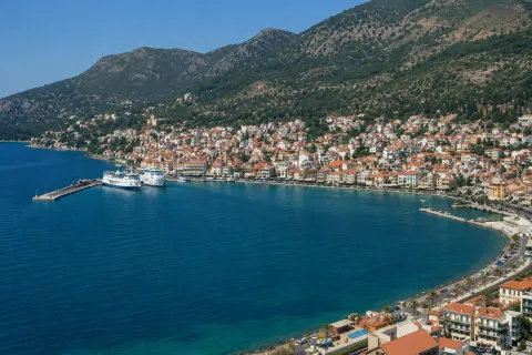
The settlement extends along the coast, around a small harbour and a series of beaches, houses, accommodation facilities, tavernas and cafés. Most activities are concentrated near the sea, creating a destination where visitors can easily explore the main points of interest on foot.
Ireon’s distinctive identity is directly connected with the ancient Sanctuary of Hera, located east of the present-day settlement. The beach, the fishing tradition, the archaeological site, the Tower of Sarakini and contemporary cultural events combine to create a place with several historical and cultural dimensions.
📍 Location and natural environment
Ireon is located on the southern coast of eastern Samos, approximately 7.5 kilometres west of Pythagoreio. It is built almost at sea level, at an average elevation of around 10 metres, where the Chora plain meets the Aegean Sea.
Behind the settlement extend low hills, olive groves and cultivated land, while to the east lies the flat area surrounding the ancient Heraion and the Imbrasos River. The landscape is more open and gentle compared with the mountainous areas of the island.
The coastline forms small beaches and sheltered areas for boats. Sea conditions vary depending on the wind, although the village’s southern position generally creates different conditions from those found along the more exposed northern coast of Samos.
🏛️ Administrative identity of the settlement
Ireon is an officially registered settlement of the Municipal Community of Pagondas.
Administratively, it belongs to:
✅ The Municipal Community of Pagondas
✅ The Municipal Unit of Pythagoreio
✅ The Municipality of Eastern Samos
✅ The Regional Unit of Samos
✅ The North Aegean Region
The settlement’s official name is “Ireon”, although the Greek form “Iraio” is also widely used in everyday speech.
📜 The creation and historical development of the settlement
The modern settlement of Ireon initially developed as the coastal port of Pagondas and Myloi. Residents of these two inland villages travelled seasonally to the coast for fishing and used small huts, storage buildings and temporary shelters near the sea.
During the winter months, they returned to their villages further inland, while the coastal facilities remained primarily connected with fishing. Over time, permanent houses were constructed and the small seasonal settlement gradually developed into an established village.
The greatest transformation took place from the 1980s onwards, when tourism growth in southern Samos, the proximity of the archaeological site and the easy access from Pythagoreio led to the construction of new houses, accommodation facilities and businesses.
Some of the old fishermen’s huts that once stood along the coast were incorporated into the newer settlement or converted into restaurants and small tourism-related businesses.
📝 The name Ireon
The name of the modern settlement derives from the ancient Heraion, the great sanctuary dedicated to the goddess Hera.
The archaeological site is located approximately one kilometre east of the village centre. Its most recognisable remain is the single column that still stands upright and is known by the residents of Samos as the “Kolona”.
The names “Ireon” and “Heraion” are used today for both the modern seaside settlement and the wider area surrounding the ancient sanctuary. A distinction should therefore be made between the village and the organised archaeological site.
👥 Population and present-day life
According to the results of the 2021 Population Census, Ireon has 805 permanent residents. The population increases considerably during the summer because of visitors, holiday-home owners and employees working in tourism-related businesses.
Economic activity is mainly based on tourism, food services, accommodation and other services connected with holidays. Fishing remains part of the settlement’s identity, although it no longer has the economic importance it held in earlier periods.
During the winter, the pace of life becomes quieter and more local. Some tourism businesses close seasonally, while permanent residences and basic services continue to serve the local population.
⚓ The harbour and waterfront
The small harbour is one of the most distinctive points of Ireon. It is mainly used as a shelter for fishing boats, small private vessels and recreational craft.
The older waterfront area extends around the harbour, with houses, tavernas, cafés and small shops. The piers, boats and tables near the water preserve the settlement’s direct connection with the sea.
The waterfront is suitable for an afternoon or evening walk. Distances are short, allowing visitors to move easily between the harbour, the beaches and the dining establishments.
🏘️ The form and development of the settlement
Present-day Ireon does not have a single, clearly defined historic centre like the mountainous villages of Samos. Its development followed the coastline and the roads connecting the harbour with the beach and the inland area.
Some older low-rise buildings survive near the sea and are associated with the former fishing and agricultural use of the area. Newer houses, rental rooms, hotels and commercial premises have developed alongside them.
Buildings are generally low-rise, while most businesses and services are concentrated near the coastal road. Traffic increases during July and August, making parking close to the centre more difficult.
🏖️ Ireon Beach
The coast in front of the settlement consists of different sections with pebbles, small stones and occasional sandy areas. It is not one continuous large beach, but a series of connected swimming spots following the shape of the coastline.
Some sections are located in front of restaurants and accommodation facilities, while others are quieter. Access is easy on foot from most parts of the settlement.
The water deepens differently depending on the location, and sea conditions are affected by the wind. Families with young children should preferably choose the calmer and more sheltered sections of the coast.
A short distance to the west lies Papa Beach, a small enclosed bay and one of the best-known nearby swimming options.
🏛️ The Sanctuary of Hera
East of the modern settlement lies the ancient Sanctuary of Hera, one of the most important religious centres of the ancient Greek world.
Worship in the area has very ancient origins, and successive temples, altars, stoas and smaller sanctuaries were constructed on the site. The votive offerings discovered there demonstrate that the Heraion received visitors and dedications from many regions of the Mediterranean and the East.
During the 6th century BC, construction began on a colossal temple measuring approximately 55 by 109 metres and surrounded by 155 columns. The columns reached a height of around 20 metres, although only part of one column from the enormous structure remains standing today.
The archaeological site also includes the great altar, monument bases, architectural remains and sections of the ancient Sacred Way.
🛣️ The Sacred Way and the connection with Pythagoreio
The Sanctuary of Hera was connected with the ancient city of Samos, located on the site of present-day Pythagoreio, through the Sacred Way.
The route was approximately six kilometres long and was used for religious processions, ceremonies and the movement of pilgrims towards the sanctuary. Statues, votive offerings, funerary monuments and other works displaying the wealth of the ancient city were placed along the road.
Sections of the ancient road and some of the monuments that once stood beside it have been revealed through archaeological excavations. The route demonstrates that the Heraion and the ancient city formed a unified religious and political complex.
🌍 UNESCO World Heritage Site
Pythagoreio and the Heraion of Samos were jointly inscribed on the UNESCO World Heritage List in 1992.
Their inclusion recognises the exceptional importance of ancient Samos in architecture, sculpture, engineering, naval power and commerce throughout the ancient world.
The ancient sanctuary is therefore not merely a local attraction. It is a monument of international significance, bearing witness to the technological and artistic prosperity of Samos during the 6th century BC.
🏰 The Tower of Sarakini
The Tower of Sarakini, one of the most important surviving monuments from the more recent history of Samos, is located in the wider Ireon area.
The stone tower house was built in 1577 and is associated with Nikolaos Sarakinis, one of the island’s first settlers following its repopulation during the second half of the 16th century.
The building is approximately 12 metres high and consists of three floors and a basement. Its restricted entrances, defensive openings and heavy stone construction reveal its fortified character.
Beside the tower stands a twin church dedicated to Saint John the Theologian and Saint George, dating from the beginning of the 17th century.
🎶 Ireon Music Festival
The Ireon Music Festival is one of the most important contemporary cultural events on Samos.
It began in the summer of 2004, when a group of residents and music enthusiasts organised the first three-day Ireon Rock Festival. Over the years, it developed into an established music event featuring artists and bands from Greece and abroad.
It takes place every August and attracts visitors from across Samos. During the festival, the settlement becomes particularly busy, while demand for parking and accommodation increases significantly.
🛏️ Infrastructure and tourism
Ireon offers hotels, rental rooms, small tourist accommodation facilities, tavernas, restaurants, cafés, bars, mini markets and shops serving both residents and visitors.
Most businesses operate near the waterfront. During the summer season, the settlement remains lively from morning until late at night, without having the size or density of a large tourist resort.
Most journeys within the centre can be made on foot. A car is mainly required for visiting the archaeological site, the Tower of Sarakini, neighbouring beaches and the inland villages.
🌿 The surrounding area and nearby routes
Ireon’s location makes it possible to combine a seaside visit with routes through the plain and the villages of southern Samos.
To the north lies Myloi, a village connected with the Imbrasos River, agriculture and the area’s historic watermills. Northwest of Ireon is Pagondas, the community to which the settlement administratively belongs.
To the east, the route continues towards the archaeological site, Potokaki and Pythagoreio, while the road to the west leads towards Papa Beach and the southern coastline of the island.
🌿 What to see
During your visit to Ireon, look for:
✅ The small harbour and fishing boats
✅ The waterfront and the small beaches
✅ The older buildings near the coast
✅ The Archaeological Site of the Heraion
✅ The single standing column of the Temple of Hera
✅ The great ancient altar
✅ The remains of the Sacred Way
✅ The Tower of Sarakini
✅ The twin church of Saint John and Saint George
✅ Nearby Papa Beach
✅ The Ireon Music Festival during August
🚶 Visitor experience
A visit can begin at the harbour and the waterfront. From there, you can walk along the coast, observe the boats and continue towards the settlement’s small beaches.
The visit can then continue at the Archaeological Site of the Heraion, located only a few minutes away by car or approximately half an hour on foot, depending on your starting point.
A basic walk through the settlement requires approximately 1–1.5 hours. When combined with a visit to the archaeological site, a meal and swimming, Ireon can easily become a half-day or full-day destination.
📆 When to visit
Spring: A suitable season for visiting the archaeological site, walking and exploring the plain before the intense summer heat.
Summer: The liveliest period, with accommodation and dining establishments fully operational, suitable swimming conditions and more cultural events.
August: A particularly busy period, especially during the days of the Ireon Music Festival.
Autumn: A good choice for a quieter visit, photography and exploring the monuments without the peak summer crowds.
Afternoon and evening: Ideal hours for walking around the harbour and dining near the sea.
🧭 How to get there
Ireon is accessible by paved road from Pythagoreio, Chora, Myloi, Pagondas and the other areas of southern Samos.
Ireon is approximately:
✅ 7.5 kilometres from Pythagoreio
✅ 22 kilometres from the town and port of Samos
✅ 31 kilometres from Karlovasi
✅ 28 kilometres from Marathokampos
✅ 1 kilometre from the Archaeological Site of the Heraion
✅ A few minutes by car from Samos Airport
The road is paved and suitable for a standard car. During the peak summer season, additional care is needed because of increased traffic and limited parking near the beach.
ℹ️ Useful information
✅ Official settlement name: Ireon
✅ Commonly used names: Ireon and Iraio
✅ Character: Seaside settlement and tourist destination
✅ Location: Southern coast of Samos
✅ Municipal Community: Pagondas
✅ Municipal Unit: Pythagoreio
✅ Municipality: Eastern Samos
✅ Regional Unit: Samos
✅ Region: North Aegean
✅ Population in 2021: 805 permanent residents
✅ Elevation of the central settlement: Approximately 10 metres
✅ Main historical monument: Archaeological Site of the Heraion
✅ Monument of more recent history: Tower of Sarakini
✅ Main cultural event: Ireon Music Festival
✅ Nearby beach: Papa Beach
✅ GPS coordinates of the centre: 37.665649, 26.883921
✅ Road access: Paved road
✅ Recommended visiting time: From 1–2 hours to a full day
✅ Suitable for: Seaside walks, swimming, dining, photography, archaeological visits, cultural events and accommodation


Add new comment