
Pagondas of Samos
🏡 Pagondas, Samos – The Amphitheatrical Village with Its Historic Square and Folklore Museum
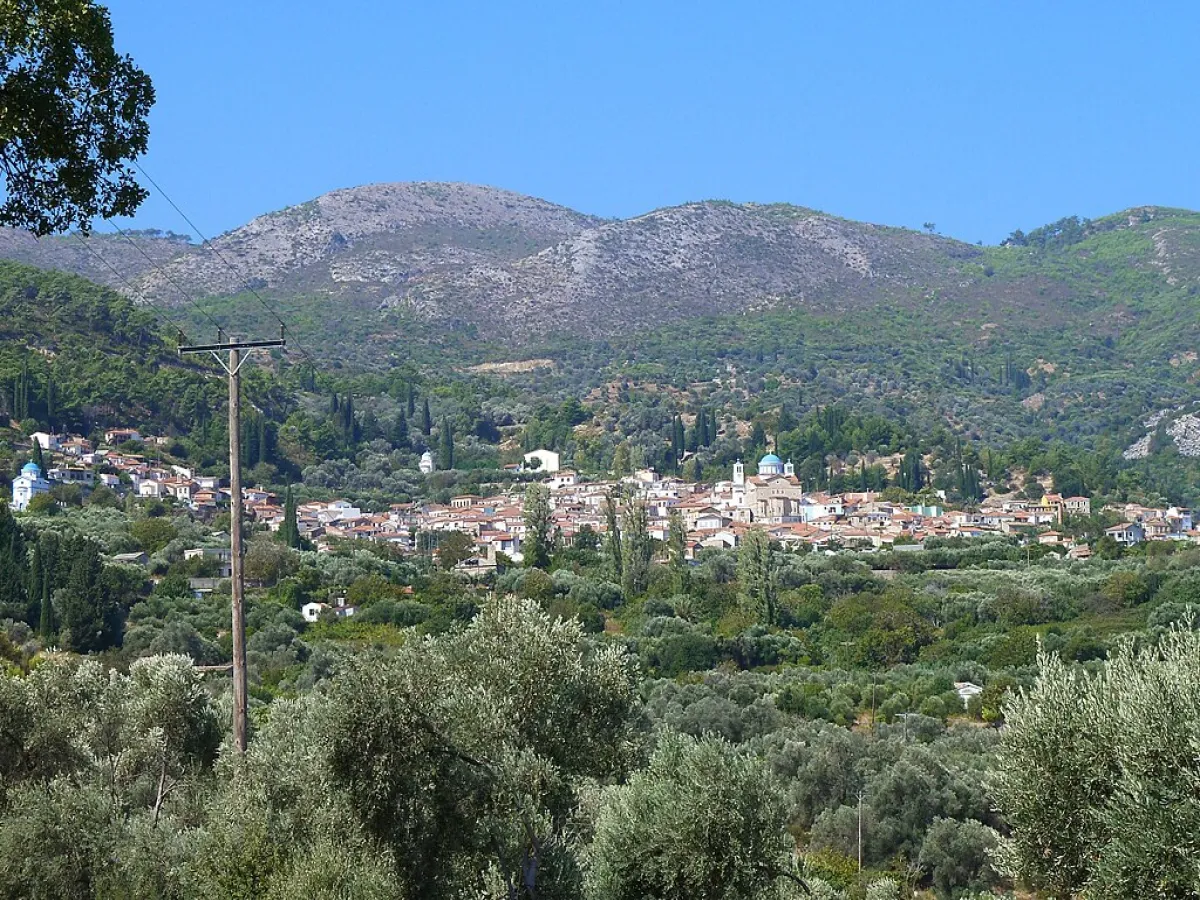
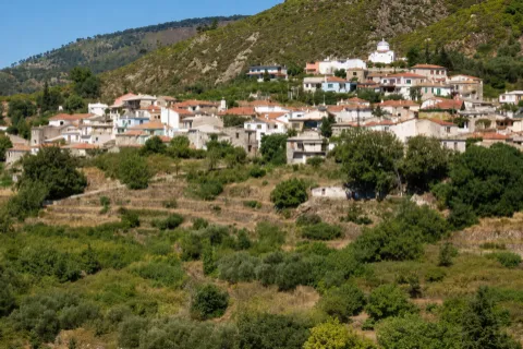
Pagondas is one of the oldest and largest agricultural villages in southern Samos. It is built amphitheatrically on the eastern foothills of Bournias Hill, a branch of Mount Ampelos, also known as Karvounis, at an altitude of approximately 260 metres.
From the higher parts of the village, the view extends across the fertile plain of Chora, the airport, the Bay of Pythagoreio and, when visibility is clear, towards the coast of Asia Minor. The traditional residential centre, the large square, the historic churches, the public washhouse and the folklore museum form the characteristic image of Pagondas.
According to the 2021 census, the settlement has 497 permanent residents. It is the administrative seat of the Municipal Community of Pagondas and belongs to the Municipal Unit of Pythagoreio, the Municipality of Eastern Samos, the Regional Unit of Samos and the North Aegean Region.
📍 Location and Character
Pagondas lies in the southern part of Samos, west of the fertile Chora plain and northwest of Iraio. The village develops across sloping terrain, with its houses arranged in successive levels along the hillside.
Its amphitheatrical layout provides open views towards the east and southeast. To the west, the landscape becomes more mountainous, with low hills, cultivated land and routes continuing towards Spatharaioi and Pyrgos.
Olive groves, vineyards, orchards and small family-owned plots extend around the settlement. The village’s close connection with the Chora plain and the coastal area of Iraio shaped its economic and social life for centuries.
📜 One of the First Villages of Modern Samos
Pagondas is among the first settlements established after the repopulation of Samos, which began during the second half of the 16th century. Its foundation is generally placed in approximately the same period as the establishment of the neighbouring village of Myloi.
The first residents are associated with populations who returned or moved to Samos after the island’s long period of depopulation. Families from other regions of the Greek world gradually settled there as well, contributing to the development of a sizeable agricultural community.
📝 The Name of Pagondas
The older name “Krimizi” appears in local historical references. It is associated with the Turkish word kırmızı, meaning red, and is believed to refer to the reddish soil and clay used in the area’s earliest buildings.
The most widely accepted explanation for the present name connects the village with settlers who came from Pagontas in Evia. A local interpretation also associates the name with the presence of springs, although this is not regarded as the main historical explanation.
🏛️ Administrative Development
On 21 September 1918, Pagondas was designated as the administrative seat of the newly established Community of Pagondas.
Under the Kapodistrias administrative reform of 1997, it became part of the Municipality of Pythagoreio. In 2010, it was incorporated into the unified Municipality of Samos and, since 2019, has belonged to the Municipality of Eastern Samos.
The present Municipal Community of Pagondas includes the village of Pagondas, the coastal settlement of Iraio and the settlement of Kolona, where the archaeological site of the Heraion of Samos is located.
👥 Population Development
Pagondas had a larger population in the past, when agriculture, olive cultivation, viticulture and household production employed a greater number of local families.
The settlement had 980 residents in 1991, followed by 764 in 2001 and 518 in 2011. According to the 2021 census, its permanent population stood at 497 residents.
Despite the gradual decline, Pagondas remains a lively village with year-round residents. Its relatively short distance from Iraio, the airport and Pythagoreio allows many inhabitants to combine village life with employment in the coastal and tourist areas.
🏘️ The Village Today
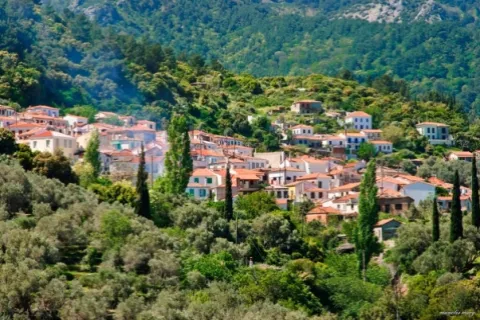
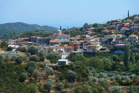
Pagondas has a compact residential centre with older and newer houses, small neighbourhoods and uphill roads following the natural slope of the terrain.
In the inner lanes, visitors can see houses with stone foundations, plastered façades, tiled roofs, wooden frames and flower-filled courtyards. Old terraces, retaining walls, steps and narrow passages complete the appearance of the traditional village.
Pagondas has been designated a settlement of exceptional natural beauty because of its architectural character and harmonious integration into the rural landscape. This protected status is accompanied by specific conditions governing new construction and building restoration.
🌳 The Central Square
The square is the main centre of social life in Pagondas. It is spacious and shaded by large plane trees and mulberry trees, providing welcome coolness during the summer months.
Traditional cafés, places to eat and several of the village’s essential shops are gathered around it. Social meetings, cultural events and some of the community’s most important celebrations take place here.
The square is also the most convenient starting point for exploring the lanes, the folklore museum, the old olive mill and the historic churches.
🏛️ The Folklore and Historical Museum
The Folklore and Historical Museum of Pagondas was created by the Omonoia Cultural Association, founded in 1976. After two years of preparation, the museum opened in 1984 in the former Primary School and is regarded as the first organised folklore museum on Samos.
Its rooms recreate the spaces and display the objects of a traditional Samian home, including the kitchen, sitting room, bedroom, low dining table, woven fabrics, furniture and everyday household utensils.
A separate section is dedicated to the traditional ground-floor storeroom, with a loom, agricultural tools, storage vessels, harvesting equipment and objects connected with rural and household production.
⚙️ The Old Mechanical Olive Mill
An old mechanical olive mill stands close to the square and reflects the importance of olive cultivation to the village economy.
Transporting and processing the olive harvest formed a major part of everyday life, especially during the autumn and winter months. The machinery and working areas of the mill illustrate the transition from older manual methods to the mechanised production of olive oil.
⛪ The Church of Agia Triada
Agia Triada is one of the two principal parish churches of Pagondas. It is a three-aisled church in the Byzantine style, built in 1878 according to plans by architect Emmanouil Kapsalis.
The church is an important religious landmark and remains closely connected with the liturgical and social life of the community. Its feast is celebrated on the Monday of the Holy Spirit.
🕯️ The Church of the Nativity of Christ
The Church of the Nativity of Christ is among the older religious monuments of Pagondas and is associated with the earliest stages in the development of the settlement.
Its marble bell tower is a distinctive architectural feature rising above the roofs of the surrounding houses. Icons and religious heirlooms preserved inside reflect the village’s long ecclesiastical tradition.
🚰 The Public Washhouse
The old public washhouse survives on the western side of Pagondas and is directly connected with daily life before running water became available inside homes.
Communal washhouses served both as practical working spaces and as places of social contact. From the area around the washhouse, there is a characteristic view over the village rooftops, the Chora plain and the eastern coast of Samos.
🫒 Olive Cultivation and Agricultural Life
The economic development of Pagondas depended heavily on cultivating the fertile land extending towards the Chora plain and Iraio.
Olives remain the most important crop, while vineyards, vegetable gardens, orchards and fruit trees can also be seen. Small family properties and rural roads around the village preserve the cultivated character of the landscape.
Silk production was also significant in the past, an activity that required both silkworm breeding and the cultivation of mulberry trees.
🍇 Vineyards and Local Production
Vineyards remain a characteristic element of the landscape surrounding Pagondas. Grapes and wine were traditionally produced on a family scale alongside olive cultivation.
Stone terraces and small cultivated slopes show how residents made use of the inclined terrain. Although vineyards cover less land today than in the past, they remain part of the village’s agricultural identity.
🌿 The Natural Environment
The landscape around Pagondas combines cultivated land, olive groves, vineyards, low Mediterranean vegetation and hills covered with pine trees and shrubs.
During spring, the slopes become intensely green and fill with wildflowers. In summer, the countryside becomes drier, while olive trees and orchards preserve the cultivated appearance of the area.
The village’s position provides cooler afternoon conditions than the coastal areas, although its climate is not as cool as that of the higher mountain villages of Samos.
🥾 Rural Roads and Historic Routes
Small rural roads and older routes begin in Pagondas and lead towards the surrounding cultivated land, Myloi, Iraio and the western hillsides.
In the Kamara–Kryo Nero area, towards the valley of the Imbrasos River, remains of old mills have been reported. The area is connected with the historical use of water for grinding grain and supporting agricultural production.
The condition of the trails may vary according to vegetation, rainfall and work carried out on nearby properties. Longer routes require suitable footwear, sufficient water and reliable orientation.
🏝️ The Connection with Iraio
Iraio lies approximately 6.5 kilometres southeast of Pagondas and belongs to the same Municipal Community.
The relationship between the two settlements is close. Pagondas represents the historic agricultural centre of the inland area, while Iraio developed as a coastal settlement with fishing and tourist activity.
Near Iraio lies the archaeological site of the Heraion of Samos, which forms part of the UNESCO World Heritage property together with ancient Pythagoreio.
🎭 Cultural and Social Life
The Omonoia Cultural Association has played an important role in preserving local traditions, establishing the folklore museum and organising social and cultural activities.
During the summer months, the square and other public spaces host musical evenings, presentations, religious celebrations and community gatherings. These events strengthen the connection of younger generations and people living away from the island with their home village.
🌿 What to See
During your visit to Pagondas, take time to discover:
✅ The central square with its plane and mulberry trees
✅ The uphill lanes and old neighbourhoods
✅ The Folklore and Historical Museum
✅ The former Primary School
✅ The mechanical olive mill near the square
✅ The Church of Agia Triada
✅ The Church of the Nativity of Christ
✅ The marble bell tower
✅ The traditional public washhouse
✅ The viewpoints over the Chora plain
✅ The olive groves, vineyards and stone terraces
✅ The rural routes towards Kamara and Kryo Nero
✅ Nearby Iraio and the archaeological site
🚶 The Visitor Experience
A visit can begin in the square and continue towards the folklore museum, the old olive mill and the two historic churches.
It is then worth following the uphill lanes towards the western side of the village and the public washhouse, where the view over the settlement and the plain becomes more open.
The gradients are moderate to steep in certain places, so comfortable footwear is recommended. Approximately 90 minutes to two hours are sufficient for a relaxed visit to the main points. More time is required when the visit includes the museum or a longer walking route.
📆 When to Visit
Spring: The best period for walking, flowering hillsides and clear views over the plain.
Summer: Choose the morning or late afternoon, when the square and lanes are cooler.
Cultural event period: The square becomes livelier with musical and community activities.
Feast of Agia Triada: Religious services and community gatherings take place.
Autumn: Suitable for quiet walks and scenes connected with agricultural work.
Winter: The village maintains its year-round daily life, although care is required on steep and slippery sections following heavy rainfall.
🧭 How to Get There
Pagondas is reached by paved road from Chora, Iraio and the wider airport area. The final kilometres are uphill and include several bends.
Pagondas lies approximately 6.5 kilometres from Iraio, 10 kilometres from Samos Airport, 12 kilometres from Pythagoreio, 26 kilometres from Samos Town, 35 kilometres from Karlovasi and 30 kilometres from Marathokampos.
The main roads are accessible with a conventional car. Streets become narrower inside the settlement and parking is limited, so it is preferable to leave the vehicle in a safe place near the square and continue on foot.
ℹ️ Useful Information
✅ Administrative community: Municipal Community of Pagondas
✅ Municipal unit: Pythagoreio
✅ Municipality: Eastern Samos
✅ Regional unit: Samos
✅ Population of the settlement in 2021: 497 residents
✅ Population of the settlement in 2011: 518 residents
✅ Altitude: Approximately 260 metres
✅ Type: Semi-mountainous, historic and agricultural village
✅ Period of foundation: Second half of the 16th century
✅ Administrative seat since: 21 September 1918
✅ Settlements of the community: Pagondas, Iraio and Kolona
✅ Designation: Settlement of exceptional natural beauty
✅ Central square: Shaded by plane and mulberry trees
✅ Parish churches: Agia Triada and the Nativity of Christ
✅ Construction date of Agia Triada: 1878
✅ Museum: Folklore and Historical Museum of Pagondas
✅ Year the museum opened: 1984
✅ Cultural association: Omonoia
✅ Historic agricultural activities: Olive cultivation, viticulture and silk production
✅ Distance from Iraio: Approximately 6.5 kilometres
✅ Distance from Samos Airport: Approximately 10 kilometres
✅ Distance from Pythagoreio: Approximately 12 kilometres
✅ Distance from Samos Town: Approximately 26 kilometres
✅ Distance from Karlovasi: Approximately 35 kilometres
✅ Distance from Marathokampos: Approximately 30 kilometres
✅ Postal code: 83103
✅ GPS coordinates: 37.6730, 26.8317
✅ Road access: Paved uphill road with bends
✅ Exploration: Mainly on foot
✅ Suggested visiting time: Approximately 90 minutes–3 hours
✅ Ideal for: Traditional architecture, folklore, history, rural landscapes, photography and walking


Add new comment