
Nikoloudes of Samos
🌳 Nikoloudes, Samos – The Small Mountain Settlement with the Centuries-Old Plane Tree
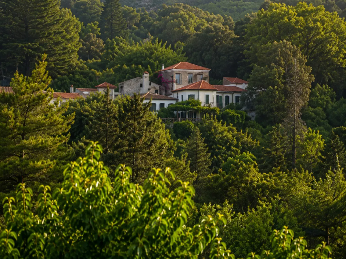
Nikoloudes is a small mountain settlement in northwestern Samos, between Leka and Kosmadaioi. It lies within a lush landscape of dense forests, ravines, springs, old olive groves and vineyards, at an altitude of approximately 400–420 metres.
The large plane tree beside the traditional fountain, the few stone houses, the Church of Agios Ioannis the Theologian and the old footpaths create the image of a small rural settlement that retains a close relationship with the natural environment and the history of Kosmadaioi.
According to the official permanent population figures from the 2021 census, Nikoloudes has 8 permanent residents. Administratively, it belongs to the Municipal Community of Kosmadaioi, the Municipal Unit of Karlovasi and the Municipality of Western Samos. The municipality forms part of the Regional Unit of Samos in the North Aegean Region.
📍 Location and Character
The settlement lies on the mountain road connecting Leka with Kosmadaioi, within the wider area of the northeastern foothills of Mount Kerkis and close to the locality of Kastri. Nikoloudes is approximately 2–3 kilometres from Kosmadaioi and a few kilometres from Leka.
The area is surrounded by plane trees, chestnut trees, black pines, cypresses, olive trees and vineyards. Small ravines descend between the slopes and, after periods of rainfall, carry running water and form small seasonal waterfalls.
The limited development and absence of extensive tourism infrastructure allow the forest and rural landscape to remain the dominant features of the area.
📝 The Name and the Tradition of the First Settler
Nikoloudes belonged to a group of small rural settlements that developed around Kosmadaioi. Their names were connected with families or early settlers who established themselves in different parts of the mountainous region.
According to local tradition, the name Nikoloudes comes from one of the first residents, referred to as Nikolou or Nikolaos Nikolou. The best-known account describes him as a livestock farmer who initially built a simple shelter from which to watch over his animals. A small residential community gradually developed around it. This story forms part of the area’s oral tradition rather than a fully documented account of the settlement’s foundation.
📜 The Small Settlements of Kosmadaioi
Until the end of the 19th century, the wider area of Kosmadaioi included several smaller settlements known as Kasolides, Galathrides, Antonakides, Plakiotes, Migardes and Nikoloudes.
These small communities developed around cultivable land, springs, grazing areas and forests. Their distance from the main village allowed farmers and livestock breeders to remain close to their fields, vineyards and animals.
During the period of the Samian Revolution, from 1821 to 1824, the mountain settlements of the area also served as safer refuges for families from Karlovasi when fears of an attack from the sea increased.
🏛️ Administrative Development
Nikoloudes was officially incorporated into the Community of Kosmadaioi on 21 September 1918, when the community was established with Kosmadaioi as its administrative centre.
Under the Kapodistrias administrative reform of 1997, the settlement became part of the Municipality of Karlovasi. In 2010, it was incorporated into the unified Municipality of Samos and, since 2019, has belonged to the Municipality of Western Samos.
👥 Population and Present-Day Life
Nikoloudes has always had a small population, mainly connected with farming, viticulture and livestock breeding. The 2001 census recorded 29 residents, followed by 11 in 2011 and 8 permanent residents in 2021.
The small population does not mean that the settlement is abandoned. Some houses continue to be used permanently or seasonally, while fields, olive groves, vineyards and livestock facilities preserve the agricultural role of the area.
During summer and periods of agricultural work, the presence of people increases. In winter, everyday activity is limited and the settlement becomes particularly quiet.
🏘️ The Form of the Settlement
Nikoloudes does not have a large square or a densely developed village centre. The houses and agricultural buildings are grouped along a short section around the main road and the old cobbled lanes.
Stone houses, low farmhouses, courtyards, storage buildings, livestock shelters and auxiliary structures survive, reflecting the traditional farming and pastoral life of the area. Some buildings remain habitable, while others have been abandoned or are used for storage.
The architecture is simple and functional, without large mansions or elaborate decorative elements. Stone, wood and tiled roofs dominate the older buildings.
⛪ The Church of Agios Ioannis the Theologian
On the southwestern side of the settlement, close to the cemetery and the end of the old path from Kosmadaioi, stands the Church of Agios Ioannis the Theologian.
The church is the principal religious landmark of Nikoloudes and is connected with the families who lived or cultivated land in the area. Small passages from its courtyard lead towards the houses, the central road and the paths through the surrounding countryside.
🌳 The Large Plane Tree and the Fountain
At the northern exit of the settlement stands a large, centuries-old plane tree beside a traditional fountain. The site is one of the most distinctive landmarks of Nikoloudes and a natural resting point for residents and hikers.
Local accounts describe the plane tree as exceptionally old and often suggest that it may be close to 900 years of age. However, no published scientific dendrochronological study has confirmed its precise age. It is therefore more accurate to describe it as a centuries-old plane tree without assigning an exact date.
An old path begins near the plane tree and descends through a ravine with plane trees, chestnut trees and black pines.
💧 Springs, Ravines and Running Water
Water played a decisive role in the establishment and survival of the small mountain settlements in the area. Springs, fountains and small ravines supplied water for residents, animals and crops.
Near the route towards Nikoloudes is a spring known as Tou Bouz’ i Vrysi, while watermills once operated in neighbouring ravines. Their ruins survive among the dense vegetation.
Water flow varies according to the season. The streams are stronger after winter and spring rainfall, while during a dry summer they may become significantly reduced.
🚿 The Old Washhouses Along the Wider Route
Traditional fountains and public washhouses were important centres of everyday life in the mountain villages. Along the wider Leka–Kastania–Kosmadaioi–Nikoloudes hiking route, old washhouses with stone basins, ruined watermills and former agricultural facilities survive.
The well-known reference to an abandoned washhouse with stone basins concerns the section of the route near Leka. There is insufficient documentation to date a washhouse within Nikoloudes itself with certainty to the 16th century.
🫒 Farming, Viticulture and Livestock Breeding
The economy of Nikoloudes was historically based on farming and livestock breeding. Olive trees, vineyards, fruit trees and small vegetable gardens were cultivated on the terraces surrounding the settlement.
Viticulture was particularly important in the wider Kosmadaioi area. Grapes were used to produce wine, grape must and raisins, while the remaining grape pomace was distilled to make traditional Samian souma.
Livestock breeding mainly involved goats and sheep. The animal shelters, rural roads and scattered auxiliary buildings continue to reflect the settlement’s long association with animal husbandry and local production.
🥾 The Old Footpaths
Before the construction of the modern road network, Nikoloudes was connected with Leka, Kastania and Kosmadaioi by stone-paved paths.
Sections of the old paving still survive inside the forest. The routes pass through olive groves, vineyards, ravines, pine forests and viewpoints overlooking Karlovasi and the northern coastline.
The paths were not used solely for the movement of residents. They also served for transporting grapes, olives, timber, food and animal feed between the small settlements.
🚶 The Circular Hiking Route
Nikoloudes is a stop on the marked circular route:
Leka – Kastania – Kosmadaioi – Nikoloudes – Leka
The complete route is approximately 11.3 kilometres long, requires around 6 hours and is classified as difficult, mainly because of its duration, elevation changes and certain steep uphill sections.
The section between Kosmadaioi and Nikoloudes follows old cobbled lanes and woodland paths. From the large plane tree, the route continues towards the ravines and forests north of the settlement.
🍽️ Services and Facilities
There is no organised tourism market, petrol station, pharmacy or permanently operating dining establishment in Nikoloudes. The nearest basic services are available in Leka, Kosmadaioi and, most importantly, Karlovasi.
Visitors coming for hiking should carry water and basic supplies, even when they are aware of a nearby spring. Water availability at natural fountains may be affected by the season and rainfall.
Parking is informal, in available spaces close to the road. Vehicles must not obstruct access to houses, agricultural plots or forest tracks.
🌿 What to See
During your visit to Nikoloudes, take time to discover:
✅ The large centuries-old plane tree
✅ The traditional fountain beside the plane tree
✅ The Church of Agios Ioannis the Theologian
✅ The old stone houses and farmhouses
✅ The narrow cobbled lanes of the settlement
✅ The old livestock shelters and agricultural buildings
✅ The paths towards Kosmadaioi and Leka
✅ The ravines with plane and chestnut trees
✅ The viewpoints overlooking Karlovasi
✅ The old olive groves and vineyards
✅ The ruins of watermills in the wider area
✅ The forested landscape on the slopes of Mount Kerkis
🚶 The Visitor Experience
A short visit can begin at the Church of Agios Ioannis the Theologian and continue through the small settlement towards the large plane tree and fountain.
Approximately 30–45 minutes are sufficient for a simple walk among the houses, cobbled lanes and plane tree. Visitors following part of the old paths should allow one to two hours.
The complete circular hike through Leka, Kastania and Kosmadaioi requires considerably more time, good physical condition and appropriate preparation.
📆 When to Visit
Spring: The best period for running water, flowering landscapes and mild temperatures.
Summer: Morning or late afternoon is preferable, as exposed sections of the route may become hot.
Autumn: A particularly attractive period, with agricultural activity, ripe grapes, harvesting and changing colours in the vegetation.
October and November: The traditional period for distilling grape pomace to produce souma in the wider area.
Winter: The landscape carries more water, but some paths may become muddy or slippery after heavy rainfall.
🧭 How to Get There
Road access is from Karlovasi through Leka and the mountain route towards Kastania and Kosmadaioi.
The road is paved but includes uphill sections, bends and places where it becomes relatively narrow. It is accessible with a conventional car when driven carefully.
Nikoloudes lies approximately 2–3 kilometres by road from Kosmadaioi and around 10–12 kilometres from the wider Karlovasi area, depending on the starting point and chosen route.
ℹ️ Useful Information
✅ Official name: Nikoloudes
✅ Character: Small mountain settlement with a farming and livestock-breeding tradition
✅ Location: Northwestern Samos
✅ Wider mountain area: Northeastern foothills of Mount Kerkis
✅ Nearby villages: Kosmadaioi, Leka and Kastania
✅ Administrative community: Municipal Community of Kosmadaioi
✅ Municipal unit: Karlovasi
✅ Municipality: Western Samos
✅ Regional unit: Samos
✅ Region: North Aegean
✅ First official administrative registration: 21 September 1918
✅ Population in 2021: 8 permanent residents
✅ Population in 2011: 11 permanent residents
✅ Population in 2001: 29 residents
✅ Altitude: Approximately 400–420 metres
✅ Principal natural landmark: Centuries-old plane tree
✅ Traditional feature: Fountain beside the plane tree
✅ Principal church: Agios Ioannis the Theologian
✅ Historic activities: Farming, viticulture and livestock breeding
✅ Main crops: Olives, vines and fruit trees
✅ Traditional product of the wider area: Souma
✅ Marked hiking route: Leka–Kastania–Kosmadaioi–Nikoloudes–Leka
✅ Length of the circular route: Approximately 11.3 kilometres
✅ Duration of the complete hike: Approximately 6 hours
✅ Distance from Kosmadaioi: Approximately 2–3 kilometres by road
✅ Distance from Karlovasi: Approximately 10–12 kilometres
✅ Postal code: 83200
✅ GPS coordinates: 37.7722, 26.6589
✅ Road access: Paved mountain road
✅ Organised parking area: None
✅ Tourism services within the settlement: Very limited
✅ Suggested visiting time: Approximately 45 minutes–2 hours
✅ Ideal for: Hiking, nature, photography, rural landscapes and peaceful exploration



Add new comment