
Kosmadaioi of Samos
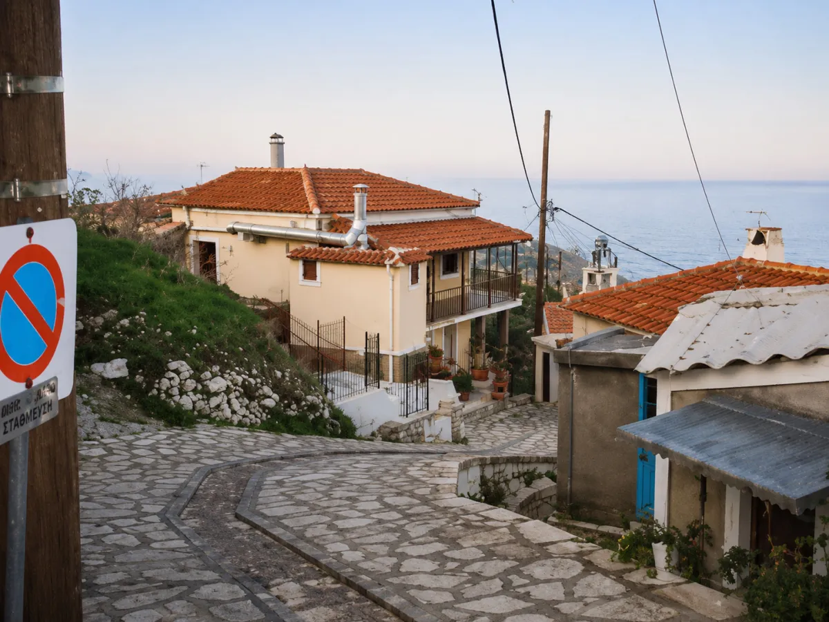
🏔️ Kosmadaioi, Samos – The Mountain Community on the Slopes of Mount Kerkis
The Municipal Community of Kosmadaioi is located in northwestern Samos, on the green slopes of Mount Kerkis. Its administrative seat is the mountain village of Kosmadaioi, while the community also includes the small settlement of Nikoloudes.
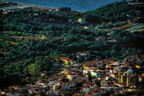
Built at an altitude of approximately 570 metres, the village is surrounded by woodland, vineyards, olive groves and mountain farmland. Its elevated position offers open views towards Karlovasi, the northwestern coastline, the Aegean Sea and, when the atmosphere is clear, the coast of Asia Minor.
Kosmadaioi preserves the peaceful character of an authentic Samian village, with narrow lanes, traditional houses, the parish Church of the Annunciation of the Virgin Mary and direct access to the mountain landscape of Kerkis.
📍 Location and Natural Environment
The village is built on the northeastern side of Mount Kerkis, among steep slopes, small valleys and dense vegetation. Its altitude and mountain location provide lower temperatures than the coastal areas, especially during the afternoon and evening.
The surrounding landscape includes pine trees, plane trees, shrubs, chestnut trees, vineyards and old agricultural terraces. Streams and seasonal springs create a natural environment that changes noticeably throughout the year.
From open points in the village and along the surrounding roads, visitors can see Karlovasi, northwestern Samos and the Aegean Sea. The geographical location of the village is approximately 37.7603, 26.6612.
🏛️ Administrative Identity of the Community
The Municipal Community of Kosmadaioi belongs to the Municipal Unit of Karlovasia, within the Municipality of Western Samos. The municipality forms part of the Regional Unit of Samos in the North Aegean Region.
The community includes:
✅ The village of Kosmadaioi, which serves as its administrative seat
✅ The settlement of Nikoloudes
The community was officially established on 21 September 1918, with Kosmadaioi as its administrative seat. During the same period, Nikoloudes and the former settlement of Kosmades were incorporated into it. Kosmades was administratively abolished in 1940.
In 1997, the community became part of the Municipality of Karlovasia. In 2010, it was incorporated into the unified Municipality of Samos and, since 2019, it has belonged to the Municipality of Western Samos.
📝 The Name Kosmadaioi
According to local tradition, the name of the village is connected with one of the earliest residents of the area, Kosmas, who settled there with his family after moving from the nearby village of Kastania.
The name “Kosmadaioi” gradually developed from the name of this original family group. The creation of place names from family names or early settlers is also found in other communities of Samos.
📜 The Earlier Settlement Clusters
The Kosmadaioi area did not initially develop as a single unified village. According to local historical tradition, several small settlement clusters and family groups were scattered across the area under the names:
✅ Kasolides
✅ Galathrides
✅ Antonakides
✅ Plakiotes
✅ Migardes
✅ Nikoloudes
Their names were connected with local families or early residents. Over time, most of these clusters were abandoned or absorbed into the wider social and agricultural life of Kosmadaioi.
Nikoloudes is the only one that remains today as a separate officially recognised settlement within the community.
🇬🇷 Kosmadaioi During the Greek Revolution of 1821
The mountainous and protected location of the area became particularly important during the Greek Revolution of 1821. According to local tradition, families, women and children from Karlovasi moved towards the small settlement clusters around Kosmadaioi to seek protection from possible attacks.
The difficult slopes, dense vegetation and distance from the sea provided greater safety than the coastal areas of northwestern Samos.
👥 Population and Present-Day Life
According to the most recent tables based on the 2021 census, 64 permanent residents were recorded in the village of Kosmadaioi and 7 permanent residents in Nikoloudes. The total recorded population of the two settlements was 71 residents.
The population has declined significantly compared with previous decades. In 2001, Kosmadaioi had 152 residents and Nikoloudes 29, giving the former community a total population of 181.
Despite the demographic decline, the village maintains permanent life and strong connections with people originating from the community who now live elsewhere on Samos or outside the island. Activity increases during the summer months, particularly during local events and religious celebrations.
🏘️ The Form and Architecture of the Village
Kosmadaioi has a compact layout adapted to the slope of the mountain. Houses are built around the central area, the parish church and the narrow lanes that rise and descend between the neighbourhoods.
Traditional houses with stone foundations, tiled roofs, wooden doors and windows, external stairways and small courtyards have been preserved. Restored homes and newer buildings that generally respect the scale of the mountain village stand among them.
The village can easily be explored on foot, although several lanes have steep inclines. The quiet atmosphere, shade and limited traffic allow visitors to discover the architecture and everyday life of the community at a relaxed pace.
⛪ The Church of the Annunciation of the Virgin Mary
The parish church of Kosmadaioi is dedicated to the Annunciation of the Virgin Mary and forms the main centre of religious life in the village.
The church stands within the main residential area and brings the residents together during major religious celebrations and services. Its feast day is celebrated on 25 March, the Feast of the Annunciation and a national holiday in Greece.
The area around the church forms one of the most characteristic parts of the village, from where visitors can continue towards the older neighbourhoods.
🌿 The Agricultural Economy
The economy of Kosmadaioi was traditionally based on agriculture and livestock farming. Viticulture, olive cultivation and vegetable production were among the principal activities of the residents.
The mountain slopes were cultivated using terraces and small family-owned fields. Grapes were used for wine production, while olives, vegetables, honey and livestock products supplied both local households and the local market.
Agricultural activity has declined compared with the past, but it remains visible in the landscape through vineyards, olive groves, gardens and old stone terraces.
🌿 Nikoloudes
Nikoloudes is a small mountain settlement belonging to the Municipal Community of Kosmadaioi. It lies approximately three kilometres northeast of the main village.
The settlement developed as a separate family and agricultural cluster and preserves traditional houses, old lanes and a strong natural character. Its position between Kosmadaioi and the lower slopes towards Karlovasi places it along an interesting mountain route.
According to the latest data from the 2021 census, Nikoloudes has 7 permanent residents.
⛪ The Zoodochos Pigi Dependency at Kakoperato
Southwest of Kosmadaioi, inside a secluded gorge of Mount Kerkis, stands the small monastic dependency of Zoodochos Pigi at Kakoperato, also known as Hatzimanolis.
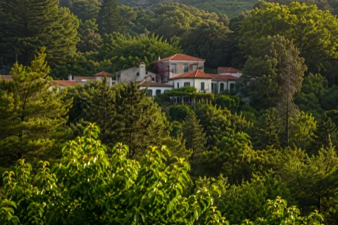
The complex includes a small church dedicated to Zoodochos Pigi and a two-storey building with monastic cells. It is surrounded by plane trees, pine trees, shrubs and steep rocky slopes, creating one of the most isolated religious landscapes in western Samos.
The exact date of its foundation has not been documented. Its present form is probably connected with the 19th century or a later period. Its small scale and remote setting distinguish it from the larger monasteries of the island.
🥾 Mountain Routes and Hiking
The area around Kosmadaioi is suitable for mountain exploration, hiking and discovering the western slopes of Kerkis. Old agricultural roads and paths connect the village with Kastania, Nikoloudes, Leka and the deeper gorges of the mountain.
The route towards Kakoperato is particularly interesting, as the landscape becomes steeper and more densely wooded. The terrain includes uphill sections, rocky surfaces, streams and areas with limited shade.
Not all routes have consistent or continuous waymarking. For longer hikes, good orientation, sufficient water and suitable footwear are essential, especially when moving away from the village.
🌲 Nature on the Slopes of Kerkis
Mount Kerkis forms one of the most dramatic mountain landscapes of Samos. Around Kosmadaioi, steep peaks are combined with wooded gorges, small cultivated areas and open viewpoints overlooking the Aegean Sea.
In spring, the vegetation is dense and the slopes fill with wildflowers. During summer, the wooded areas provide shade and cooler temperatures, while in autumn the landscape gains richer colours and becomes suitable for gentle hiking and photography.
🎶 Cultural and Volunteer Activities
Cultural and volunteer initiatives play an important role in maintaining the social life of the community. Local associations and volunteer groups occasionally organise music evenings, dances, religious celebrations and gatherings in the central area of the village.
Volunteer activity connected with civil protection and wildfire prevention is particularly important, as the community lies within an extensive mountainous and forested area.
🌿 What to See
During your visit to the Municipal Community of Kosmadaioi, take time to discover:
✅ The central area and the old neighbourhoods
✅ The parish Church of the Annunciation of the Virgin Mary
✅ The traditional houses and uphill lanes
✅ The viewpoints overlooking Karlovasi and the Aegean Sea
✅ The vineyards, olive groves and old agricultural terraces
✅ The settlement of Nikoloudes
✅ The forest and agricultural routes of Mount Kerkis
✅ The Kakoperato Gorge
✅ The Zoodochos Pigi monastic dependency
🚶 The Visitor Experience
A visit can begin in the centre of the village and at the Church of the Annunciation of the Virgin Mary. From there, the narrow lanes lead towards the older neighbourhoods, traditional houses and open viewpoints.
Visitors can then continue towards Nikoloudes or follow one of the agricultural roads surrounding the village. A visit to Kakoperato requires more time and preparation, as the site lies inside a mountain gorge.
Approximately 45–60 minutes are sufficient for a basic tour of the village. With a visit to Nikoloudes and a short route through the surrounding countryside, the excursion can last two to three hours.
📆 When to Visit
Spring: The best season for green landscapes, wildflowers, running water and hiking.
Summer: Suitable for an afternoon visit, when temperatures in the mountains are lower than along the coast.
Autumn: Ideal for peaceful walks, photography, vineyards and agricultural landscapes.
25 March: The feast day of the Annunciation of the Virgin Mary, to which the parish church is dedicated.
🧭 How to Get There
Kosmadaioi is accessible by a paved mountain road with several bends and uphill sections. The route is suitable for a conventional car, although careful driving is required, particularly during rain or fog.
The village lies approximately:
✅ 12 kilometres from Karlovasi
✅ 3 kilometres from Nikoloudes
✅ 9 kilometres from Marathokampos via the mountain route
✅ 42 kilometres from Samos Town
✅ 41 kilometres from Samos International Airport
The route from Karlovasi passes through rich vegetation and gradually climbs the slopes of Mount Kerkis.
ℹ️ Useful Information
✅ Official name: Municipal Community of Kosmadaioi
✅ Administrative seat: Kosmadaioi
✅ Character: Mountainous, agricultural and traditional community
✅ Location: Northwestern Samos, slopes of Mount Kerkis
✅ Villages and settlements of the community: Kosmadaioi and Nikoloudes
✅ Municipal unit: Karlovasia
✅ Municipality: Western Samos
✅ Regional unit: Samos
✅ Region: North Aegean
✅ Establishment of the community: 21 September 1918
✅ Population of Kosmadaioi in 2021: 64 permanent residents
✅ Population of Nikoloudes in 2021: 7 permanent residents
✅ Total population of the settlements: 71 permanent residents
✅ Altitude of the village: Approximately 570 metres
✅ Parish church: Annunciation of the Virgin Mary
✅ Feast day: 25 March
✅ Main traditional activities: Viticulture, olive cultivation, agriculture and livestock farming
✅ Nearby religious site: Zoodochos Pigi monastic dependency at Kakoperato
✅ Alternative name of the dependency: Hatzimanolis
✅ Distance from Karlovasi: Approximately 12 kilometres
✅ Postal code: 83200
✅ GPS coordinates: 37.7603, 26.6612
✅ Road access: Paved mountain road
✅ Suggested visiting time: Approximately 1–3 hours
✅ Ideal for: Nature, mountain exploration, history, photography, hiking and peaceful routes




Add new comment