
Drakai Village

🌄 Drakaioi, Samos – The Remote Village at the Western Edge of Mount Kerkis
Drakaioi is located at the northwestern edge of Samos, on the steep western slopes of Mount Kerkis. It is a small mountain village with a strong sense of isolation, open views over the Aegean Sea and close connections with agriculture, forestry, the sea and traditional wooden shipbuilding.
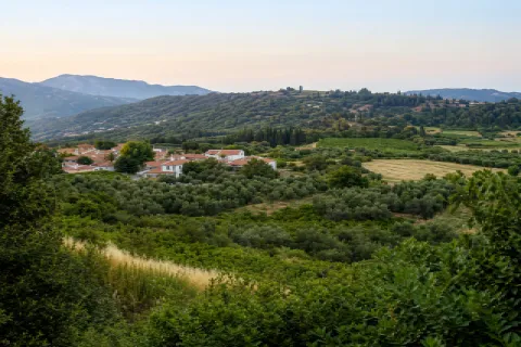
The settlement is built at an elevation of approximately 295 metres, within a rugged landscape of pine forests, olive groves, rocky slopes and deep ravines. Its location provides unobstructed views towards Ikaria, Fournoi and, when visibility is clear, more distant islands of the Aegean.
The paved road effectively ends at Drakaioi. Beyond the village, dirt tracks and hiking trails lead towards Ormos Agiou Isidorou, Megalo Seitani and the remote coastline of northwestern Samos.
📍 Location and natural environment
Drakaioi is situated on the northwestern lower slopes of Mount Kerkis, in an area characterised by steep gradients and rugged terrain. Although the village lies only about 10 kilometres from Karlovasi in a straight line, there is no direct road crossing the rocky mountainsides and the protected Seitani area.
Road access follows a long route around the mountain through Marathokampos and Kallithea, considerably increasing the actual driving distance from Karlovasi. The final section towards the village passes through densely vegetated slopes, open viewpoints over the sea and numerous bends.
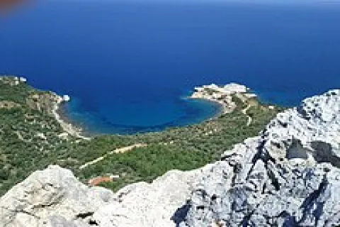
The landscape surrounding Drakaioi combines pine forests, olive groves, Mediterranean scrub and limestone formations. To the north and west, the land descends sharply towards the Aegean, forming remote coastlines, small bays and sea caves.
🏛️ Administrative identity of the community
The Municipal Community of Drakaioi belongs to the Municipal Unit of Karlovasia, within the Municipality of Western Samos, the Regional Unit of Samos and the North Aegean Region.
The community includes two officially registered settlements:
✅ Drakaioi
✅ Ormos Agiou Isidorou
The Community of Drakaioi was officially established on 21 September 1918, with the village as its administrative centre. Agios Isidoros was first recognised as a settlement in 1928, administratively abolished in 1940 and officially recorded again in 1981 under the name “Ormos Agiou Isidorou”.
In 1997, the two settlements became part of the former Municipality of Karlovasia. In 2010, they were incorporated into the unified Municipality of Samos, and since 2019 they have belonged to the Municipality of Western Samos.
📜 The creation and historical development of the village
The permanent development of Drakaioi probably began during the early 18th century. The village is not mentioned in known descriptions of Samos from the 17th century, supporting the view that it was founded after the island’s repopulation.
The strategic position of the area, overlooking the sea passages between Ikaria and Fournoi, appears to have been important during earlier periods as well. Ruins of small observation posts and locations used to monitor maritime traffic have been recorded in the wider area, although there is no reliable evidence of an organised ancient city on the site of the present village.
During the period of the Principality of Samos, Drakaioi and neighbouring Kallithea jointly formed the Municipality of Kalampaktasia. Following the union of Samos with Greece in 1912, the two villages were reorganised as separate communities.
📝 The name Drakaioi
The most widely accepted explanation connects the name of the village with one of the area’s first settlers, who carried the surname “Drakos”. This interpretation was recorded by the Samian writers Emmanouil Kritikidis in 1869 and Epameinondas Stamatiadis in 1886.
A second theory links the name with the ancient Tower of Drakano, located at the eastern edge of Ikaria. Drakano served as an observation point over the sea passages between Samos, Ikaria and Fournoi, all of which can be seen from the area of Drakaioi.
Neither explanation has been conclusively proven. The connection with the surname “Drakos” is generally presented as the more probable historical interpretation.
👥 Population and present-day life
According to the final results of the 2021 Population Census, Drakaioi has 75 permanent residents. Ormos Agiou Isidorou remains an officially recognised settlement, although no permanent residents were recorded there in the same census.
In 2011, the Municipal Community of Drakaioi had a total population of 115 residents: 97 in Drakaioi and 18 in Ormos Agiou Isidorou. The decline to 75 residents within a decade reflects the demographic challenges faced by small and remote settlements in western Samos.
The local economy traditionally depended on olive cultivation, vegetable farming, beekeeping, limited livestock breeding, logging and charcoal production. Small-scale silkworm breeding and carob cultivation were also recorded during the 19th century.
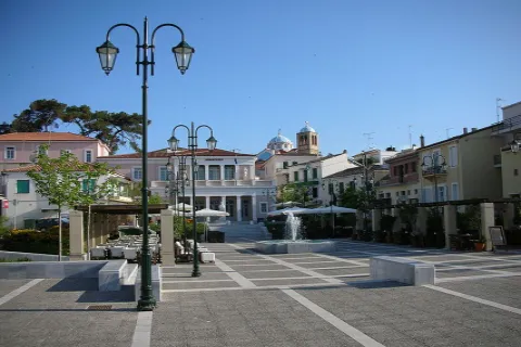
Today, daily life remains quiet and strongly local. The small square and the few meeting places serve as the social centre of the village, particularly for permanent residents and those who return during the summer months.
🛣️ Isolation and the construction of the road
Until 1965, Drakaioi and Kallithea did not have a road suitable for motor vehicles connecting them with the rest of the island. People, agricultural products and supplies were transported along footpaths, by pack animals or by sea through Ormos Agiou Isidorou.
The construction of the road significantly improved access without completely ending the village’s isolation. The route towards Karlovasi remains long and indirect, because the exceptionally steep terrain of Mount Kerkis prevents a direct road connection through the Seitani area.
This geographical isolation contributed to the decline in population. At the same time, it helped preserve the peaceful character, small scale and authentic appearance of the village.
🏘️ The form and architecture of the village
Drakaioi extends across sloping ground, with small neighbourhoods, narrow passages and houses adapted to the natural gradients of the mountain.
The central settlement includes old stone houses, tiled roofs, wooden window frames, external staircases and small courtyards. Newer buildings stand beside them, many following the simple proportions and limited scale of the older homes.
The square and the central streets can easily be explored on foot. Some slopes are steep, while several passages are narrow and unsuitable for vehicle access or parking.
⛪ Churches and religious tradition
The parish church of the village is dedicated to Saints Constantine and Helen and forms an important part of the religious and social life of the local community.
Numerous chapels and older places of worship can be found in the surrounding area, including the cemetery church of Saint George and the chapel of Saint Demetrios, which celebrates its feast day on 26 October.
The mountainous and remote Kerkis area is also connected with a long ascetic and monastic tradition. Caves, small monastic retreats and isolated places of worship testify to the use of the mountain as a place of seclusion and prayer during Byzantine and post-Byzantine times.
🌲 The natural environment of Mount Kerkis
Mount Kerkis, also known as Kerketeas or Kerketeus, is the largest mountain massif in western Samos and reaches an elevation of 1,434 metres at the summit of Vigla. Drakaioi lies on its lower northwestern slopes, far from the main summit ridge.
The area is characterised by forests of Turkish pine and black pine, cypress trees, Mediterranean scrub, olive groves and rocky formations. The major differences in elevation create striking changes between forested slopes, bare limestone cliffs and steep coastal areas.
The wider Kerkis zone is included in two Natura 2000 protected areas: Special Area of Conservation GR4120003 and Special Protection Area GR4120008, which is particularly important for birds of prey and other bird species.
🏖️ Megalo and Mikro Seitani
A hiking trail of approximately four kilometres begins near Drakaioi and leads towards Megalo Seitani. From there, the coastal route continues eastwards towards Mikro Seitani, Potami and Karlovasi.
Both beaches form part of the Natura 2000 protected area GR4120003, whose full designation includes Mount Kerketeas, Mikro and Megalo Seitani, the forests of Kastania and Lekka, and part of the northwestern coastline.
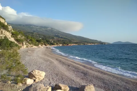
Megalo Seitani is an extensive sandy and pebbled beach surrounded by steep mountains and natural vegetation. Mikro Seitani is smaller and narrower, forming within an impressive rocky opening.
Access requires proper preparation. The trails have no organised facilities, continuous shade or guaranteed drinking-water sources. Suitable footwear, sufficient water, sun protection and prior knowledge of the route are essential.
🥾 Hiking trails and dirt-road routes
Drakaioi is a starting point for several routes of varying difficulty:
✅ Hiking trail towards Megalo Seitani
✅ Continuation towards Mikro Seitani and Potami near Karlovasi
✅ Dirt road towards Ormos Agiou Isidorou
✅ Route towards Varsamo Beach
✅ Dirt-road connection towards Kallithea
✅ Route towards Agia Aikaterini and Panagia Makrini
✅ Mountain route towards the summit of Vigla
The ascent towards Vigla from the area of Panagia Makrini is particularly demanding and should not be treated as a simple recreational walk. It is suitable for experienced hikers with appropriate equipment, reliable route knowledge and favourable weather conditions.
⚓ Ormos Agiou Isidorou
Approximately 4.5 kilometres west of Drakaioi lies Ormos Agiou Isidorou, also locally known as Ai Sideris. The small coastal settlement served as the maritime port of Drakaioi and Kallithea.
Before the construction of the road in 1965, Agios Isidoros was essential for the connection of the two villages with Karlovasi and the rest of the island. The movement of people, products and supplies depended largely on sea transport.
The settlement takes its name from the small church dedicated to Saint Isidore of Chios, the patron saint of sailors. The chapel is believed to date from 1530 and celebrates its feast day on 14 May.
🪵 The traditional shipyard and wooden shipbuilding
Agios Isidoros was one of the most important centres of traditional wooden shipbuilding on Samos. During the 20th century, six small shipbuilding and repair yards operated in the bay, employing shipwrights, loggers, timber transporters and craftsmen from Drakaioi, Kallithea and other villages.
The shipyards constructed and repaired traditional wooden vessels, including trechantiria, trates, peramata, varkalades, karavoskaro-type vessels, fishing boats, small boats and wooden cargo craft. Durable Samian pine from the forests of western Samos was one of the main construction materials.
The area was officially designated as a protected historic site in 2007. Wooden shipbuilding continues on a smaller scale, preserving a traditional craft included in Greece’s National Inventory of Intangible Cultural Heritage.
Access from Drakaioi follows a dirt road approximately 4.4 kilometres long. Road conditions may change after rainfall or maintenance work, and a vehicle with increased ground clearance is preferable.
🌅 Views and sunset
The western position of Drakaioi provides unobstructed views over the sea passages between Samos, Ikaria and Fournoi.
When visibility is clear, Ikaria, Fournoi and other island ridges of the eastern Aegean can be seen. To the southwest, the view opens towards the Gulf of Marathokampos and the western coastline of Mount Kerkis.
The late afternoon is particularly suitable for visiting, as the sun sets in front of the village and illuminates the mountain slopes, stone houses and the open sea.
🛏️ Facilities and everyday services
Drakaioi is not an organised tourist resort. Options for food, coffee, shopping and accommodation are limited and may operate seasonally or according to varying opening hours.
Visitors should carry drinking water and basic supplies and make sure their vehicle has sufficient fuel before beginning the journey. A wider selection of shops and services is available in Kallithea, Marathokampos and Kampos Marathokampou.
Parking is mainly available near the entrance and at the more open parts of the village. Driving through the narrow central streets is not practical, and exploration should continue on foot.
🌿 What to see
During your visit to Drakaioi, look for:
✅ The village square and small residential centre
✅ The old stone houses and narrow passages
✅ The parish church of Saints Constantine and Helen
✅ The viewpoints towards Ikaria and Fournoi
✅ The sunset over the western Aegean
✅ The trail towards Megalo Seitani
✅ The route towards Mikro Seitani and Potami
✅ Ormos Agiou Isidorou
✅ The historic shipyard and old shipbuilding structures
✅ The dirt-road route towards Varsamo Beach
✅ The chapels and mountain routes of the surrounding area
🚶 Visitor experience
A visit can begin at the entrance to the village and continue on foot towards the square, the parish church and the older neighbourhoods.
A basic walk through Drakaioi and the nearby viewpoints requires approximately one hour. With a stop for coffee or food and time to watch the sunset, the visit can last two to three hours.
Hiking towards the Seitani beaches, descending to Agios Isidoros or exploring the dirt-road routes requires separate planning. These excursions should not be treated as brief extensions of a simple village walk.
📆 When to visit
Spring: The best season for hiking, flowering landscapes and mild temperatures.
Summer: Suitable for combining the village with the Seitani beaches or Agios Isidoros, although protection from the heat and sufficient drinking water are essential.
Autumn: A good period for photography, quiet exploration and forest routes, provided that the weather remains stable.
Winter: The area may experience strong winds, rain, fog and more difficult road conditions.
Afternoon: The ideal time for walking through the village and watching the sunset.
🧭 How to get there
The main road access follows the route from Marathokampos, Kampos Marathokampou and Kallithea. The road is paved as far as Drakaioi but includes numerous bends, narrow sections and stretches beside steep slopes.
Drakaioi is approximately:
✅ 6 kilometres from Kallithea
✅ 29 kilometres from Marathokampos
✅ 42 kilometres from Karlovasi
✅ 58 kilometres from Pythagoreio
✅ 72 kilometres from the town of Samos
✅ 4.4–4.5 kilometres from Ormos Agiou Isidorou by dirt road
✅ Approximately 4 kilometres on foot from Megalo Seitani
Driving times may be longer than the distances suggest because of the mountainous road, continuous bends and reduced speeds along the final kilometres.
ℹ️ Useful information
✅ Official community name: Municipal Community of Drakaioi
✅ Official name of the main settlement: Drakaioi
✅ Character: Remote mountain village
✅ Location: Northwestern Samos
✅ Municipal Unit: Karlovasia
✅ Municipality: Western Samos
✅ Regional Unit: Samos
✅ Region: North Aegean
✅ Community established: 21 September 1918
✅ Official settlements in the community: Two
✅ Settlements: Drakaioi and Ormos Agiou Isidorou
✅ Population in 2021: 75 permanent residents
✅ Population of Drakaioi in 2021: 75 residents
✅ Population of Ormos Agiou Isidorou in 2021: No permanent residents recorded
✅ Elevation of the main settlement: Approximately 295 metres
✅ Parish church: Saints Constantine and Helen
✅ Main natural feature: Western slopes of Mount Kerkis
✅ Protected areas: Natura 2000 GR4120003 and GR4120008
✅ Main hiking route: Drakaioi – Megalo Seitani
✅ Coastal settlement of the community: Ormos Agiou Isidorou
✅ Main cultural feature: Traditional wooden shipbuilding
✅ GPS coordinates of the centre: 37.757673, 26.610243
✅ Main road access: Paved mountain road through Kallithea
✅ Recommended visiting time: From 1–3 hours to a full day
✅ Suitable for: Traditional village exploration, photography, sunset views, hiking, nature excursions and discovering the shipbuilding tradition


Add new comment